UN
254 Forton Road
£ 173,000
Description
We don't have a Description for this property.
- Bedrooms
- 3
- Bathrooms
- 0
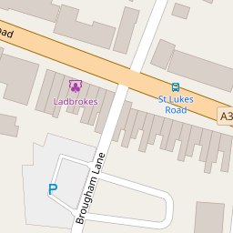

Leaflet © OpenStreetMap contributors
The heatmap indicates the level of crime in the area. The color of the heatmap indicates the crime severity and recency.
Metrics Year-on-Year
- Average area value
- 253,750.00 £Increased by 8.42 %
- Average area rental value
- 1,011.00 £/moDecreased by 7.50 %
- Est rental Yield
- 4.78 %Decreased by 14.64 %
- Crime Rate
- 17.00 %Unchanged by 0.00 %
from 234,048.00 £
from 1,093.00 £/mo
from 5.60 %
from 17.00 %
Nearby Schools
| Name | Type | Ofsted | Distance |
|---|---|---|---|
| St Mary'S Catholic Primary School | Voluntary Aided School | Requires improvement | 0.34 KM |
| Brockhurst Primary School | Community School | Good | 0.37 KM |
| St John'S, Gosport Church Of England Voluntary Aided Primary School | Voluntary Aided School | Good | 0.86 KM |
| Leesland Church Of England Controlled Infant School | Voluntary Controlled School | Good | 0.96 KM |
| Elson Junior School | Community School | Requires improvement | 1.01 KM |
Images
Nearby Streets
| Name | Average Price | Average Sqft | Distance |
|---|---|---|---|
| Mill Road | £ 0 | 0 | 0.00 KM |
| Lee Road | £ 0 | 0 | 0.00 KM |
| Palmyra Road | £ 190,000 | 0 | 0.00 KM |
| Vale Grove | £ 285,000 | 0 | 0.00 KM |
| Reed's Place | £ 190,000 | 0 | 0.00 KM |
Nearby Transport
| Name | NLC | TLC | Distance |
|---|---|---|---|
| Portsmouth Harbour | 5540 | PMH | 4.41 KM |
| Portchester | 5928 | PTC | 5.68 KM |
| Portsmouth And Southsea | 5537 | PMS | 6.25 KM |
| Ryde Pier Head | 5541 | RYP | 7.26 KM |
| Fareham | 5900 | FRM | 7.45 KM |
Nearby Listings
| Address | Price | Type | Score | Distance |
|---|---|---|---|---|
| Forton Road, Gosport, Hampshire | £ 230,000 | BUY | 6 / 10 | 0.00 KM |
| Forton Road, Gosport, Hampshire, PO12 | £ 135,000 | BUY | 5 / 10 | 0.06 KM |
| Forton Road, Gosport, Hampshire, PO12 3HF | £ 120,000 | BUY | 6 / 10 | 0.09 KM |
| Brougham Street, Gosport | £ 240,000 | BUY | Unknown | 0.13 KM |
| Bedford Street, Gosport, PO12 | £ 150,000 | BUY | 5 / 10 | 0.14 KM |
Nearby Properties
| Address | Price | Distance |
|---|---|---|
| 230 Forton Road | £ 181,500 | 0.00 KM |
| 254 Forton Road | £ 173,000 | 0.00 KM |
| 236 Forton Road | £ 110,000 | 0.00 KM |
| 252a Forton Road | £ 45,000 | 0.00 KM |
| 222d Forton Road | £ 99,000 | 0.00 KM |